Lok Sewa Tayari Exam important Update GK Questions from New Nepal Maps with Limpiadhura, Kalapani & Lipulekh. New General Knowledge GK questions from New Nepal Maps for Kharidar, Pra sa, Na Su, Adhikrit. Lok Sewa Tayari Nepal, Lok Sewa exam preparation sites for government job exams like nayab subba (naasu),kharidar , Section Officer 2076, Pra Sa, Banking Service, Corporation Service, Nepal Airlines, Nepal Telecome, Nepal Army, Nepal Police Computer operator and other Nepal Government exam.
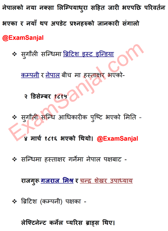
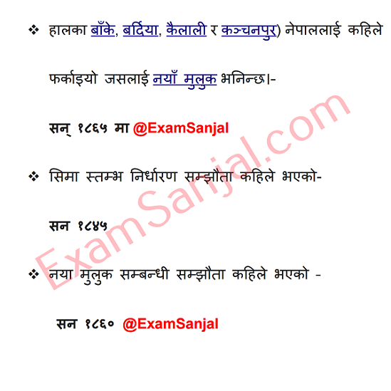
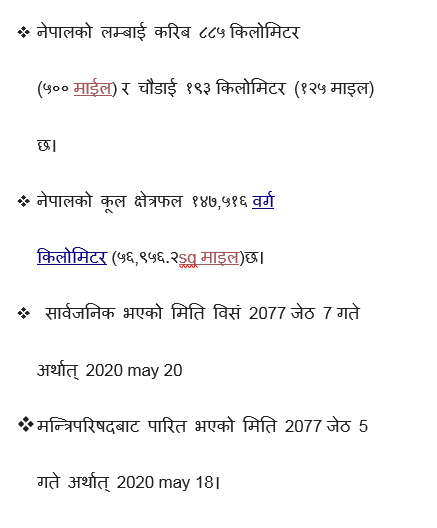
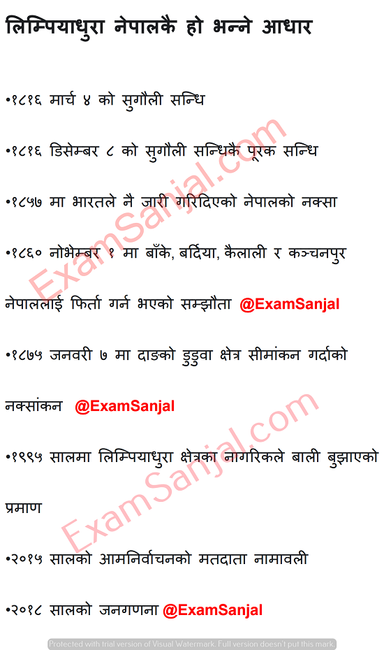
Nepal’s new map covers an area of 147,516 sq km, 10,000 copies being printed. Six months after India unveiled its new political map placing Kalapani within its borders, Nepal on Wednesday unveiled its new political map by including the region within its territory. Padma Kumari Aryal, the minister for Land Management, Cooperatives and Poverty Alleviation, unveiled the map. The new map showing Kalapani, Limpiyadhura and Lipulekh as Nepali territories was approved by the Cabinet on Monday.
The territories have been shown in Byas Rural Municipality in Darchula district of Sudurpaschim Province. With adding the disputed land that is currently occupied by India, the total area of Nepal has increased from 147,181 square kilometres to 147,516 square kilometres, according to officials. Top New Update GK from New Maps of Nepal.
Click Here for IQ Important Questions Answer Collection.
Click Here for Lok Sewa Tayari Materials.
Public Service Commission (Lok Sewa Aayog) was established in Nepal on 15 June 1951 A.D. The Commission is involved in selecting meritorious candidates required by Government of Nepal for various vacant posts of the civil service.
The continuity of PSC has never been hindered since its establishment. Present Constitution of Nepal 2007(2063 BS) has designated the Public Service Commission as an independent constitutional body.